Helsby Hill – Ramblers Walk


Helsby Hill – Ramblers Walk
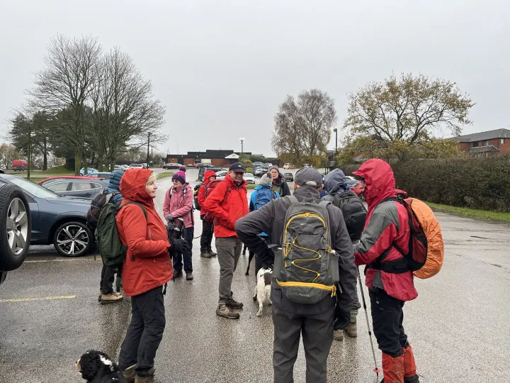
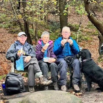
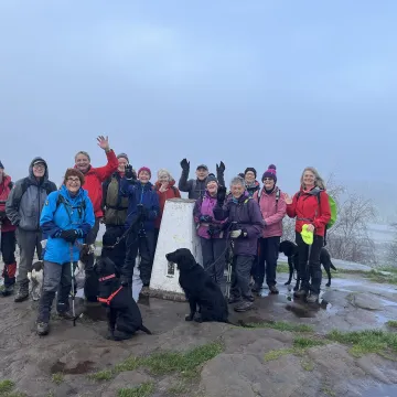
14 Audlemites (and associates!) met early last Saturday for a 6.5 mile walk at the northern end of the Sandstone Trail, led by Steve Elliott. Weather was fortunately remarkably dry compared to the BBC forecast!
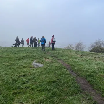
On arriving to the summit, the editor found that there was another (amateur?) Trig Point "bagger" – who knew more that he did!
The Principal Triangulation (1st Triangulation)
Period: 1783 1853.
Purpose: To establish precise geographical coordinates of major landmarks across Great Britain and Ireland for map-making and scientific (geodetic) calculations, such as determining the shape of the Earth.
Key Figures: Major General William Roy initiated the initial baseline measurement on Hounslow Heath. Most of the subsequent work was carried out under the direction of Isaac Dalby, William Mudge, and Thomas Frederick Colby.
Methodology: Surveyors used large, precision instruments like the Ramsden Theodolite to measure angles between points, often on hilltops or church steeples. The network of triangles was built upon a precisely measured baseline.
Outcome: The results formed the basis of UK maps for a century, but the system became outdated and piecemeal due to local county projections and the need for more accurate mapping in the 20th century.
The Retriangulation of Great Britain (2nd Triangulation)
Period: 1935 1962.
Purpose: To replace the outdated system with a complete new survey control network and unify all mapping onto a single national datum, projection, and reference system. This was necessary due to the rapid development of Britain after the First World War.
Key Figures: The project was led by Brigadier Martin Hotine, who designed the now-iconic concrete triangulation pillars (trig points).
Methodology: The retriangulation used thousands of concrete trig points, which provided a stable base for theodolites. Over 6,500 pillars were built, with most located so at least two others were visible in clear weather. Aerial surveying expedited work in later stages.
Outcome: The data gathered led to the creation of the OSGB36 datum and the Ordnance Survey National Grid, the national system still used as the basis for British maps today.
While modern surveying now primarily uses technologies like GPS and the active OS Net network (with just 110 points), the physical legacy of the retriangulation remains, with thousands of trig pillars still standing across the UK. Hikers often engage in "trig bagging," a hobby of visiting as many of these historic points as possible. You can find more information about these historical surveys
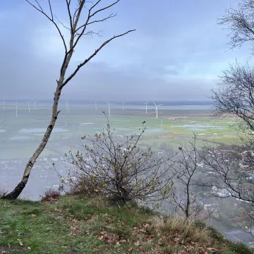
Helsby hill fort is an Iron Age hillfort overlooking the village of Helsby. It has steep cliffs on the northern and western sides, providing a natural semicircular defence. Double rampart earthworks extend to the south and east to provide protection to those flanks. Two additional banks have been discovered enclosing a rock ledge on the cliff to the north side. Excavations last century revealed a wall composed of sand and rubble, revetted with stone to the back and front. The hill has a summit of 141 m, and is a prominent landmark rising above the Cheshire Plain, with fine views overlooking the Mersey Estuary and into Wales. Much of the hill is owned and managed by the National Trust. The hill fort is protected as a Scheduled Ancient Monument.
Helsby Quarry, operational from the early 19th century until the 1920s, was a significant source of sandstone used in local construction, including notable structures like the Albert Docks in Liverpool. Sandstone was extracted from a working quarry from the early 19th century until the 1920s. Much of the stone was transported by ferry to Liverpool and Birkenhead, where several buildings, including the Customs House near Canning Dock, were built of Helsby stone. The quarry originally had its own dedicated horse-drawn tramway link to Ince Pier. After stone production ceased, it was not until the late 1980s that an alternative use was found for the site and in the intervening decades the derelict site was used as a tip by local residents.
Credits
..to Ordnance Survey and Wikipedia!

Get In Touch
AudlemOnline is powered by our active community.
Please send us your news and views using the button below:
Email: editor@audlem.org