


Application for Deleting Public Footpath FP19
I am the Audlem Parish volunteer footpath inspector for Peaks & Northern Footpaths Society – this is the charity that gave us the 8k grant for the Turnpike Field boardwalk.
As a statutory consultee, PNFS received notification from Cheshire East regarding an application for the deletion of FP19 and is currently compiling its formal response.
Audlem Parish Council has also received this notification.
My understanding is that such an application is usually based on the premise that the footpath was wrongly added onto CE s Definitive Map, possibly as early as 1953/4 when the DM first started.
CE have appointed a consultant to investigate the application, which was originally submitted in 2005.
My current research has determined the following:
The earliest OS map that I have found with FP19 shown is 1987 – I could only find a previous one for 1973 on which it was absent.
In 2005, after a complaint from a local walker regarding the condition og the footpath, Cheshire East fitted new gates at both ends.
It is currently very well trodden, showing frequent use, and is in good condition.
I am collating any evidence/opinion that supports the footpath remaining which I will then pass on to PNFS and APC for submission to CE prior to November 17th, 2024
If anyone has any information, please email me at spelliott@yahoo.co.uk
- ---------
Summary:
Application Ref: WCA/40
{
}
Wildlife and Countryside Act 1981: Definitive Map and Statement
{
}
Application for Modification Order to delete public footpath No19 in the Parish of Audlem
{
}
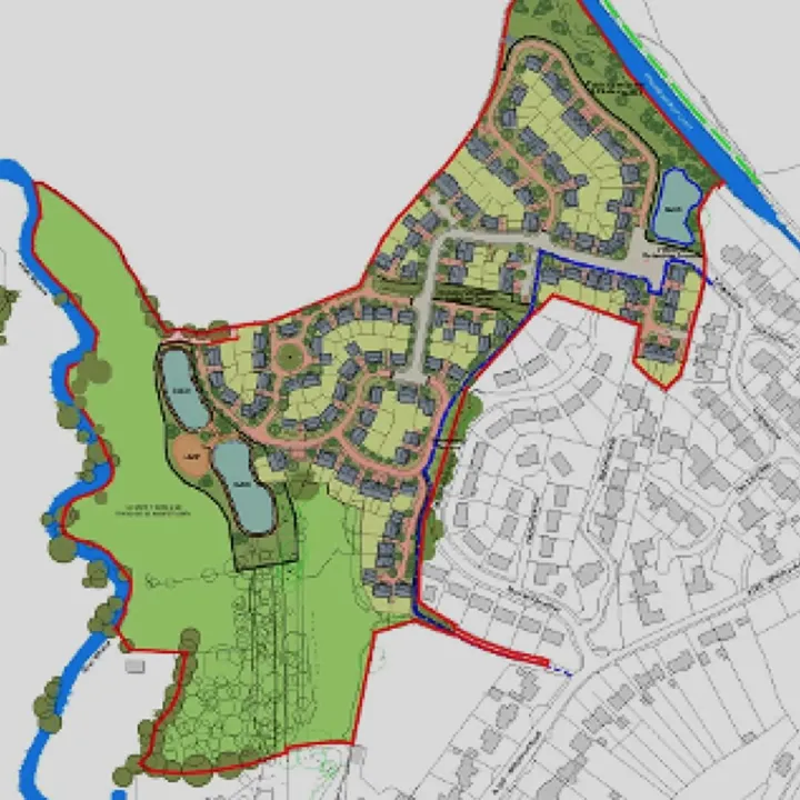
We have commenced the investigation into the application to delete public footpath No19 from the Definitive Map and Statement of Public rights of Way for Cheshire East. A plan of the footpath is attached/enclosed with this letter. You are being asked for your comments (and evidence) which may assist with the application.
{
}
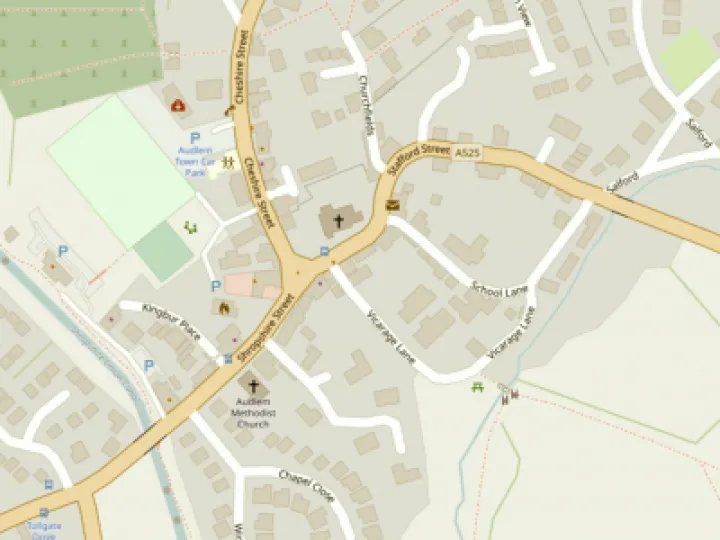
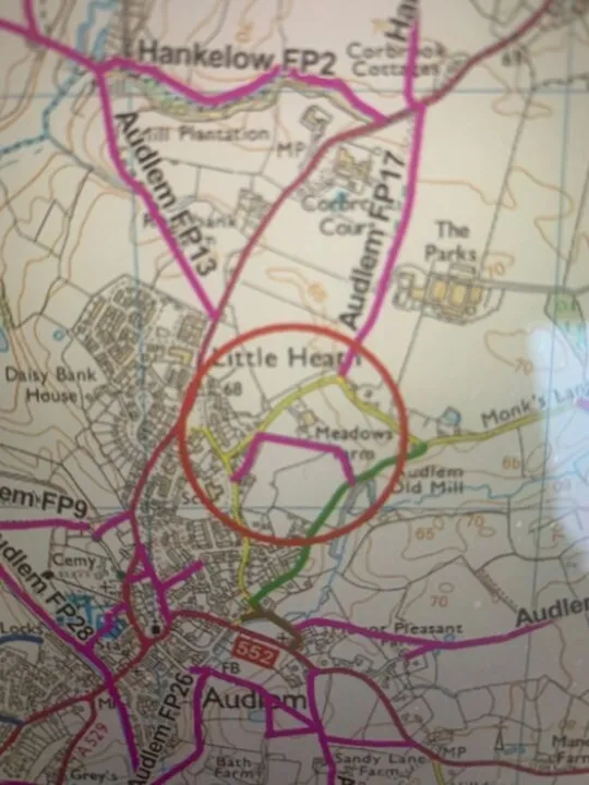
We have appointed a consultancy to investigate the above application. They are experienced with public rights of way applications and have worked with this Council before. They are undertaking the work under the instruction of Cheshire East s, Definitive Map Officer. The route is shown on the attached map and runs from OS grid reference SJ6652:4407 at bridleway no 30 at Mill Lane for a distance of approximately 290 meters to OS grid reference SJ 6629:4420 at Monks Lane.
{
}
The application was submitted to Cheshire East Council on the 20th October 2005 and is supported by witnesses statements and historical documents. Any response is required by the 17th November 2024.


Get In Touch
AudlemOnline is powered by our active community.
Please send us your news and views using the button below:
Email: editor@audlem.org