A longer walk using the South Cheshire Way


Audlem Online has been publishing this week a selection of six local walks, all featuring the canal at some stage. These walks have been selected for a new leaflet which is in preparation. Once printed (and it will be a low cost, one colour production), it will be distributed at Audlem's Tourist Information Centre at Williams' newsagents.
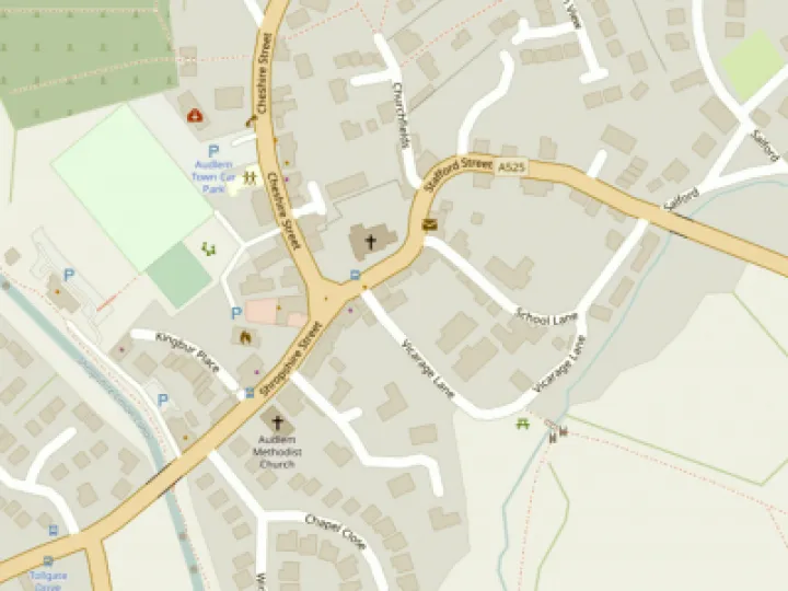
If anyone spots any problems with the directions given, please let the webteam know. For those unfamiliar with the area, the suggested walks should be used in conjunction with the Parish Paths map or OS Explorer 257, available at Williams' newsagents or the Post Office. The directions will also be published in the 'Visiting Audlem' section of Audlem Online – click Information/Visiting Audlem/Local walks. Today we feature the longest walk in the series:
South Cheshire Way and Hankelow
Allow three hours.
Leave the Square along Shropshire Street past the Methodist church. Turn right at the Bridge Inn and join the canal towpath northwards past the Shroppie Fly pub. Stay on the towpath for two miles with, initially, fine views of the fishing lakes and River Weaver. Leave the towpath at the Cool Lane bridge. Go north on Coole Lane for 300m, ignoring the footpath off to the left, before taking the South Cheshire Way footpath to the right across the fields. After a mile across fields, the path descends to the River Weaver.
Cross the bridge and follow the path as it rises along the hedgerow (part of the path is narrow with hedgerows on either side – if overgrown it's better to stay in the field) before the path emerges into a lane after passing Hankelow Hall which can be seen the left. Turn right and follow the lane into Hankelow, past the Green and duck-pond to the White Lion pub. Go straight across the main road to join Longhill Lane, then take the first lane on the right. Stay on this lane for over half a mile, ignoring a left turn, before turning right into Monks Lane. Where the lane bends right after 600m, carry straight on along the footpath to the left of the house on the bend. This is Mill Lane and it returns you to Audlem. Go straight across when it reaches the road along a small lane for 50m with the stream to your left and then turn right up Stafford St to return to the Square.
This article is from our news archive. As a result pictures or videos originally associated with it may have been removed and some of the content may no longer be accurate or relevant.


Get In Touch
AudlemOnline is powered by our active community.
Please send us your news and views using the button below:
Email: editor@audlem.org