


[It's crunch time as the application to reinstate the paths to Adderley goes to the Planning Inspectorate.
]
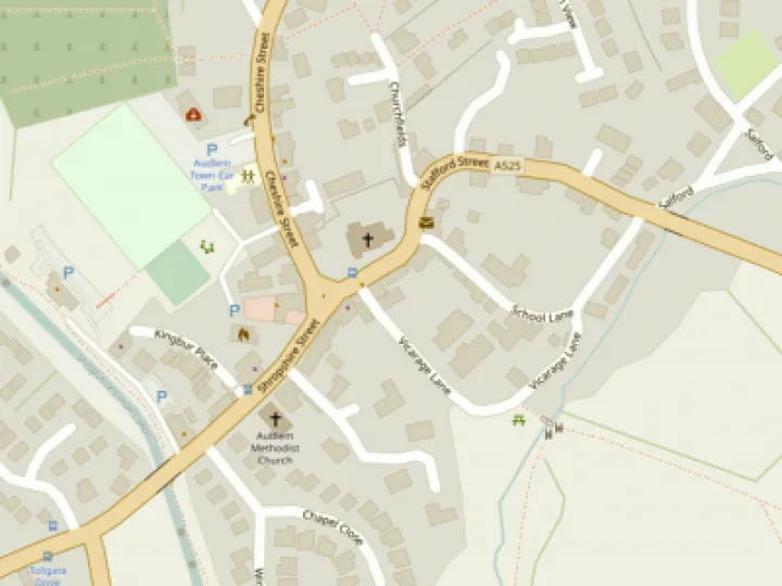
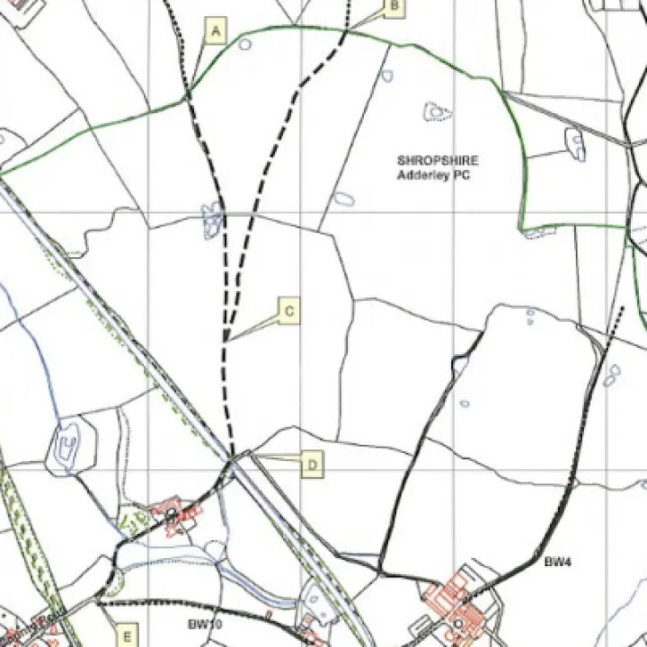
Two historic paths to Adderley from Bagley Lane were closed at the Shropshire border in the 1950's by the machinations of the owner of most of Adderley parish, Lord Corbet. "There are no public paths in Adderley." he was heard to say at the time. Finally, the official reopening order from Shropshire County Council is with the Planning Inspectorate for determination. If the order is not confirmed the paths will remain closed for ever. It has been a long haul so let's start at the beginning of my journey through the process.
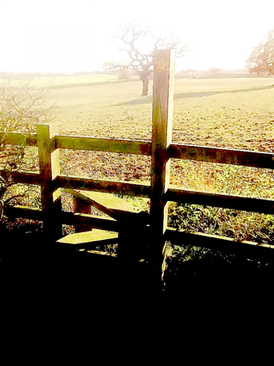
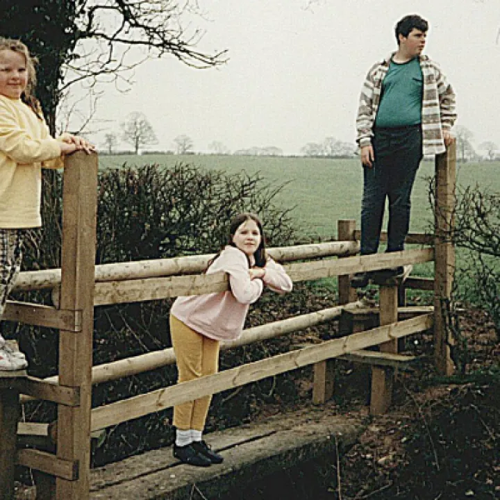
We go back to a summer day in the early 1980's. I am standing on the edge of a deep muddy ditch a field away from Bagley Lane surrounded by cubs plunging down one side and scrabbling up the other, thoroughly enjoying getting as dirty as possible. I am with my wife who is helping Tony Williamson run the village cub pack. This was a special excursion where the cubs could show their metal. The route led over fields and through hedges, passing a pond before dropping down to the canal tow path. I had not been long in the village and this was an early introduction to the delights of Audlem's footpath network.
In the early 90's Cheshire County Council put a bridge over the ditch and installed a series of inviting new stiles and signs up to and including the border hedge. A few years later Derek McKelvey, in collaboration with Cheshire, produced a map of all local paths and the two footpaths on the Shropshire side of the border were shown as 'Other routes with public access'. The Ordnance Survey maps showed only dashed black tracks, not the usual red or green public footpath markings. During this time Cheshire, Audlem Parish Council, The Ramblers Association and local people all asked Shropshire to fully open the paths but nothing happened.
We move on to 2004. I had continued using the paths but I felt uneasy and decided to make an official application to the Shropshire Rights of Way Department. This was based on over 20 years regular use by 12 users. If done 'without permission or obstruction' a route can then become a Right of Way. I only included the section to the canal as no-one dared walk past Pool House. As the old mapmakers would have written "Here be dragons". Little did I know then that Pool House would prove to be a crucial piece in our jigsaw of evidence exposing the duplicity of the Adderley Corbets.
2016 is the next significant year on my journey. Nothing had happened in the meantime. Shropshire agreed we had a good case but it was not a priority for them. The application would be dealt with during a planned survey of Adderley paths. There was no survey and the footpath application got buried under other events in my life until Celia Bloor asked me for an update. At about the same time I found that the new OS maps had omitted the dashed tracks in Shropshire. The paths just ended at the border. I gathered more evidence from users and added in the historical context with reference to old maps and tried again. This time Shropshire bit the bullet and put an experienced Rights of Way Officer onto the case. She quickly found enough evidence to justify opening the whole route to Adderley over the canal bridge and past Pool House. It has taken till this July for the order to get to the Planning Inspectorate despite a lot of encouragement -- ask the Parish Clerk! It will still take about a year for it to be determined. Patience is certainly a virtue!
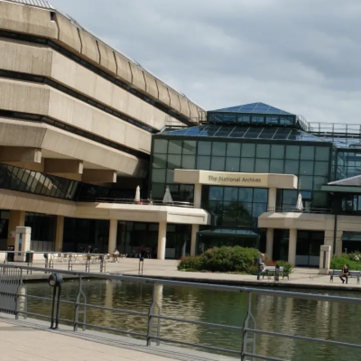
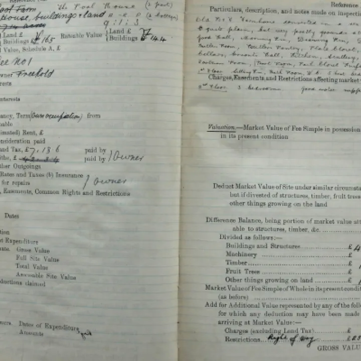
So what was the missing piece of the jigsaw? It's an entry in a surveyor's field book recording property valuations in Adderley Parish made sometime after 1910. It lay buried deep in the vaults of the National Archive at Kew until July 2017 when, armed with information from the Rights of Way Department, I located and copied it. To understand its significance we need to go back to 1910 when Lloyd George's Finance Act was passed. The Act's intention was to extract money from landowners who took advantage of rising land prices to profit from selling land they had done nothing to improve. They could get a market value reduction by declaring a Right of Way through their property. The Corbets took advantage of this and declared several on their estate. One such was our path from Adderley station through Pool Farm to the canal. Lord Corbet persuaded the surveyor to authorise a whopping £250 reduction in market value for the nuisance caused by the path past Pool House. The normal reduction allowed was £5 to £50. The Shropshire Rights of Way Office knew of the entry but did not have a copy. This declaration is strong evidence, if not proof, of a Right of Way, something conveniently forgotten by the Corbet family when Shropshire's first Definitive Map of all Rights of Way was being prepared in the late 50's.
If you have personal (as a cub?) or family memories of using the paths and have not already shared them please contact me, r.peter.k@ gmail.com. These memories may still be useful.
Peter Kay


Get In Touch
AudlemOnline is powered by our active community.
Please send us your news and views using the button below:
Email: editor@audlem.org