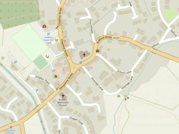
AudlemOnline Interactive Map


AudlemOnline reported a few weeks ago about the problems with using the Google maps on line, see here.
We received very little feedback about this, and we would have quietly dropped the map feature from the website, but for the fact that the mapping process is used quite a lot in other ThenMedia websites.
So we have developed a new map interface which uses OpenLayer mapping.
The MAP link in the FEATURES tab on the home page now loads this map software.
The facilities to select and highlight the location of streets, shops, etc remains the same,
However, the map itself has some differences compared with the standard Google product
- It has no satellite view nor street-view function.
- It shows footpaths – a useful addition.
- You can zoom in and out with the mouse or touchscreen
There are a couple of residual problems with our implementation
It often requires several "goes" to get it to show the map.
We have not yet updated the shops list or gazetteer to reflect recent changes in the village.
We will attend to these points as soon as we can, but meanwhile we think it is a step in the right direction.
This article is from our news archive. As a result pictures or videos originally associated with it may have been removed and some of the content may no longer be accurate or relevant.


Get In Touch
AudlemOnline is powered by our active community.
Please send us your news and views using the button below:
Email: editor@audlem.org