The Story of Audlem

Geology of Audlem
Important dates in Audlem History
Audlem (population 1,790 in a civil parish of 2,348 acres) stands at the intersection of the roads from Nantwich (Cheshire) to Market Drayton (Shropshire) and Newcastle (Staffordshire) to Whitchurch (Shropshire).
The Shropshire border lies close at just over a mile to the south on the Market Drayton road and about 3 miles to the east on the road to Woore and Newcastle. The parish includes the compact and attractive hamlet of Coxbank situated about one mile to the south between the canal and A529.
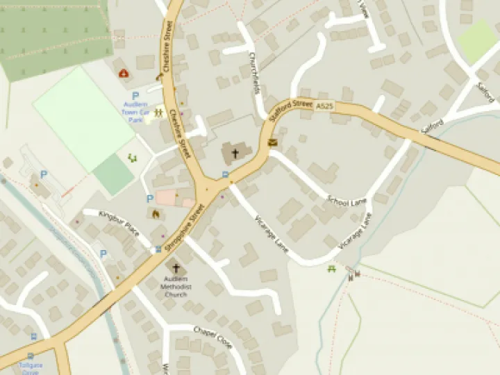
The oldest part of the village is the core at the "T" intersection of the two main roads and is dominated attractively by the ancient sandstone Church of St James built on top of a walled mound.
The village is bounded on the west by the River Weaver which flows north through fine open countryside to Nantwich.
Early Days
The Domesday Book's (1086) entry for Audlem ("Aldelime") refers only to fields, woodland, agriculture and hunting. However, by the late 13th century the church had been founded and Audlem's market charter was granted by Edward I in 1296.
Excavations to the rear of the present butcher's shop revealed the site of a pottery kiln with contemporary vessels dated to between 1250 and 1300. It therefore seems certain that Audlem has been a significant centre of population since at least that time.
Surviving older buildings
The only visible medieval building is that part of the church dated from the 14th to the 16th centuries. Buildings of the 17th century are prominently represented by Moss Hall (1616), on the north side of the village close to the canal, and the Old Grammar School (1647-55), off Vicarage Lane near the brook.
A pleasing and characterful range of buildings, with facades of the 18th to 20th centuries, line the streets radiating from the centre. They include shops, public houses and dwellings, some converted from former shops and pubs. The Butter Market alongside the church was built (or refurbished) in 1733.
The imposing Methodist Chapel dates from 1863 and, helped by its recent extension, plays an important part in the secular as well as the religious life of the community. The village extends about half a mile to the north, east and west along the main access roads.
Some new housing estates, built mainly in the 1970s, have added considerably to the population and have markedly changed the appearance of many parts of the village.
In the eastern part, just north of the Woore road, lies a small and distinctive group of older houses known as Salford which includes the attractive Baptist Chapel (1840).
Nineteenth Century
For a hundred years from the middle of the nineteenth century the population was more or less static at around 1300 to 1500. Because of some boundary changes it is difficult to be precise about trends. During this period, indeed for centuries before, agriculture was the driving force for the local economy and the main employer.
The village, being by far the largest in its immediate area and at some distance from larger towns in the days of slow transport, was substantially self-sufficient for services and day-to-day necessities.
The original staple products of oats, potatoes and hay gave way to livestock and dairy production as the nineteenth century progressed. But there was also substantial employment in supporting trades such as milling, brick making, rope making, boot making, agricultural engineering, blacksmithing and wheelwrights, as well as in the many retail shops, inns and public houses.
Of the formerly numerous mills in the district, only two buildings survive within the parish boundary -- Kingbur Mill (now the canal shop) and Swanbach Mill close to where Audlem Brook joins the River Weaver. The immaculately restored Hankelow Mill further down the Weaver is just outside the boundary.
Social life, in days of a great deal less leisure, and as exemplified by Audlem Wakes of which we have a record back as far as 1812, was rough and boisterous according to the custom of the era. It included bull and bear baiting, also cock fighting.
Transport Improvements
Roads were improved with the creation of two turnpikes in the late eighteenth and early nineteenth centuries, which became the basis of the current intersecting A525 and A529. There was a toll bar at Brown's Bank and a toll house (demolished in 1947) at the corner of the Market Drayton road in Audlem.
Further employment and activity were created by the construction of the Birmingham and Liverpool Canal between 1827 and 1835, and the Nantwich and Market Drayton Railway in 1863. The railway was never an economic success and Audlem Station was finally closed in 1964. Only slight traces of the line now remain on the west side of the village.
However the canal, now known as the Shropshire Union, has given the village a very beneficial legacy. Though commercial carrying virtually ceased in the 1950s, it was almost immediately followed by the development of the leisure boating industry which in recent years has brought tens of thousands of visitors through the village each year.
The flight of 15 locks in a mile and a half raises the canal 93ft in the Shropshire direction. With its attractive wharf and well kept towpath, it is also a magnet for walkers and casual visitors. The Overwater Marina, with over 200 berths, opened in 2010 and is one mile north of the village on the west side of the canal.
The Modern Village
The past thirty years or so can be seen as a period of rapid change and a watershed in the long history of Audlem. Agriculture, with increasing mechanisation and the use of contract services, is no longer a significant employer in the village.
Just over a quarter of the population is aged 65 or more and, of those in work, nearly a third is in managerial or professional jobs. About three quarters of the employed travel to work by car, sometimes to quite distant places.
The 1976 Village Plan
The Village Plan published in 1976 was drawn up at a time of rapidly increasing population associated with the building of new housing estates. There was understandably great concern about the effect of these on the character and appearance of the village, indeed the report noted that "parts of Audlem began to look like suburbia" and "the charming area around the canal wharf and its approaches has suffered".
There was a strong recommendation that no further estates should be built. Although some minor infilling was considered acceptable, the village had lost 12 acres of green land within the settlement boundary, and there was a strong plea that some of the remaining green spaces should be kept open in perpetuity.
Parish Plans
Two Parish Plans have been produced by teams of volunteers in 2005 and 2010. Many of the projects proposed in these plans have now been completed, notably the removal of the A525 from the Primary Road Network.
The Conservation Area
The heart of the village was designated a conservation area by Cheshire County Council in 1969. The 1976 Village Plan recommended various extensions. These were in due course adopted for Salford and the Woore road as far as Paddock Lane, also for Coxbank, but not for Little Heath, Copthorne or Swanbach.
The other main concern of the 1976 Plan was the heavy traffic through the village, particularly on the east-west A525, a problem which is still with us today. An RAC study had shown that an alternative route on the A53 to the south, though slightly longer on mileage, was quicker and needed fewer gear changes for heavy vehicles. In the 1960s a village bypass had been proposed and three different routes surveyed. However the schemes did not survive a cost/benefit analysis by the authorities.
The A525 was eventually removed from the Primary Route Network, the roads deemed most suitable for HGVs, in March 2010 after forty years of campaigning.
The 1976 Plan and associated activities by enterprising residents led to a number of successes. The Old Grammar School and the Stafford Street cottages were saved from potential demolition. The bus services (Crosville) were improved, a playground provided and a Youth Club formed. (The WI Scrapbook of 1951 mentions that a Youth Club was formed in 1943.)
Community Activities
Community activities gathered strength and developed to the point that they now attract large numbers of visitors from well beyond the normal catchment area of the village, and contribute significantly to local funds.
The early summer Carnival, which is thought of as a successor to the nineteenth century Harvest Wakes, dates from the 1960s, and has more recently become a long weekend incorporating the Arts and Music Festival.
The Amenities Society, the Parish Council and various entrepreneurial sub-groups have added to the annual festivities the Pantomime (January), "Proms in the Park", the "Funky Weekend" for young people, the Festival of Transport and the Open Gardens Weekend, the November 5th Bonfire, Carols in the Square at Christmas and Fireworks on New Year's Eve.
Indeed, there are now so many summer events that the flags in the village centre stays up for months.
This is also a village fully conscious of its ancient history. Notable in this context were the historical pageants held at Highfields in 1969 and 1983, and the celebrations in July 1996 of the 700th anniversary of the granting of Audlem's market charter.
Many of the booklets on Audlem's history were written in this period, possibly helped by the growing presence in the village of retired professional people. A full history of Audlem, incorporating much of the research previously printed in small booklet form, was published by The Local History Group in 1997.
Police and Fire Brigade
Crime and vandalism have always been with us but some may look back with nostalgia to the era when the village had a police station from which problems could be dealt with swiftly and effectively. The first station was built in Salford in 1853 and this was replaced in 1901 by the substantial brick building (now a private house) in Cheshire Street near to the present car park.
There was a resident policeman in the village until as recently as 1989. Fortunately, at least the Volunteer Fire Brigade, formed in 1899, remains a reassuring presence today.
Recent Changes
Notable changes in the village centre in recent years include the conversion of the former Crown and Lamb Hotels into dwellings, happily without major harm to the street scene in this conservation area.
Since then an even more substantial change occurred in 2005 when the site adjacent to the canal (Moseley's Yard), occupied by commercial premises since 1888, was sold to a developer. The village thereby gained more spacious premises for its Co-op store and some affordable flats. However, the opportunity was lost to increase public space in the congested village centre and provide better pedestrian access to the Wharf.
The period from 2009 to 2011 saw an upsurge in the number of shops in Audlem with an almost doubling of provision. Three new businesses were established in the Square in the old Co-op premises, new shops opened in Moseley's Yard, a small building was renovated and is now a boat-share agency while the refurbishment of the butchers shop in Cheshire Street (Oxtail & Trotter) was followed by the creation of new shops and a cafe in the old yard, now an attractive courtyard with an ice cream and confectionery shop and a barbers.
A Village Design Statement and Landscape Character Assessment in 2009, it was hoped, would give the village more influence over the future developments. In 2014 -- 15 a team of volunteers produced a detailed Neighbourhood Plan which has been submitted to Cheshire East Council and will be subject to a Referendum by local residents.
Greville Watts (with some updates by the AudlemOnline web team)
Get In Touch
AudlemOnline is powered by our active community.
Please send us your news and views using the button below:
Email: editor@audlem.org